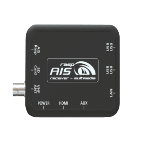
Description
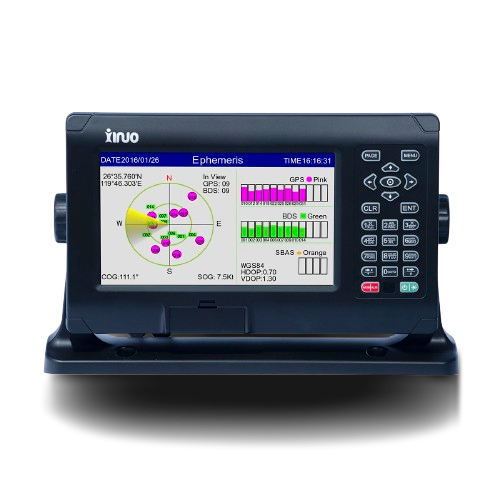
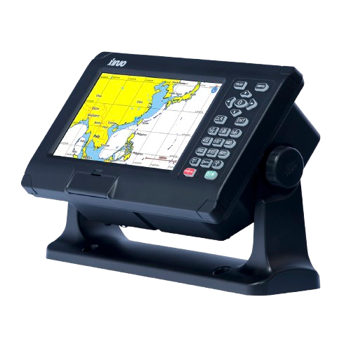
The XF-808 8″ GNSS Chart Plotter is a powerful and reliable marine navigation system designed for professional and recreational vessels. Equipped with a dual-system GNSS receiver supporting both GPS and BeiDou, it delivers accurate and stable positioning for safe navigation in all conditions. The bright 8-inch color TFT display provides clear chart detail, while multiple display modes—including standard chart, simplified chart, 3D navigation, GNSS data, and compass—make operation intuitive and adaptable.
GNSS chart plotter supports BDS, GPS dual-mode high-precision positioning, combined with self-developed SOG&COG filtering algorithm, it has advantages of stable SOG&COG, high receiving sensitivity, accurate position.
◆ Passed the EU CE certification.
◆ 8 inch color LCD with 800 x 480 resolution, wide angle of view.
◆ Classic& Utility dual operating system, you can switch freely.
◆ Built-in BDS, GPS dual-mode high-precision positioning module, the position information is stable and reliable.
◆ Support multi-language display, such as Chinese, English, Korean, etc.
◆ Many display pages can be chose and switched freely.
The Xinuo XF-808 is a compact yet powerful marine navigation instrument designed for reliable and accurate chart plotting. It integrates a GNSS receiver supporting both GPS and BDS (BeiDou) satellite systems, delivering stable and precise positioning. Thanks to its proprietary SOG & COG filtering algorithm, it ensures consistent speed-over-ground (SOG) and course-over-ground (COG) data.
Technical Specifications
| Display Unit | XF-808 | |
| Display Type | Color TFT LCD | |
| Size | 8 inch | |
| Resolution | 800 × 480 pixels | |
| Brightness | 450cd/㎡ | |
| Language | English, Simplified Chinese, Traditional Chinese, Vietnamese, Bahasa Malaysia, Turkish, Thai, Greek, Indonesian, Japanese, Korean, Spanish, Burmese, Persian | |
| Display Modes | Standard Chart View, Pure Chart View, Simple Chart View, AIS Data, Sailing Data, GNSS, 3D Navigation, Compass | |
| Memory Capacity | 50,000 waypoints, 50,000 markers, 500 routes, one route can indicate 200 waypoints , 1000 tracks, 1,600,000 track points | |
| Interface | 2 Ports NMEA0183 Output , 2 Ports NMEA0183 Input (Baud rate can be set independently) | |
| WIFI | 802.11 b/g/n | |
| Power Supply | DC10V~36V | |
| Power Consumption | 8W or less (24V DC) | |
| Environmental | ||
| Working Temperature | -15℃~+55℃ | |
| Storage Temperature | -20℃~+60℃ | |
| Waterproof | IP65 | |

Reviews
There are no reviews yet.