Description
GNSS chart plotter supports BDS, GPS dual-mode high-precision positioning, combined with self-developed SOG & COG filtering algorithm, it has advantages of stable SOG & COG, high receiving sensitivity, accurate position.
◆ Passed the EU CE certification.
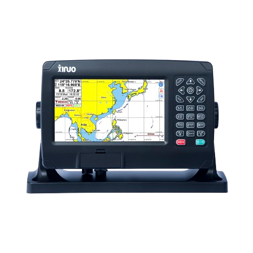
◆ 7 inch color LCD with 800 x 480 resolution, high brightness, wide angle of view.
◆ Classic& Utility dual operating system, you can switch freely.
◆ Built-in BDS, GPS dual-mode high-precision positioning module, the position information is stable and reliable.
◆ Support multi-language display, such as Chinese, English, Korean, etc.
◆ Many display pages can be chose and switched freely.
The Xinuo XF-608 is a rugged, marine-grade GNSS chart plotter with a 7-inch color TFT LCD, designed for both commercial and recreational vessels. It supports dual-mode positioning using both BDS (Beidou) and GPS, delivering stable and accurate location data through Xinuo’s SOG & COG filtering algorithm. The device features a dual-operating-system architecture (Classic and Utility modes), allowing users to switch between different UI styles based on their needs.
With multi-language support (such as English, Chinese, Korean, and more), the XF-608 is accessible to a broad user base. It offers multiple display modes, such as standard chart view, simple chart, AIS data, GNSS data, 3D navigation, and compass, to suit different navigation scenarios. The unit is CE certified per Xinuo’s product page.
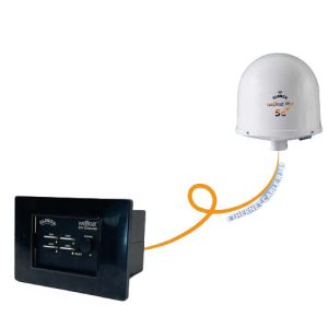
Built for marine conditions, the XF-608 has a waterproof design, offers voice broadcasting for navigation and alarms, and supports multiple mounting options (flush or multi-angle) to fit different installation needs. Its power input range is DC 10–36 V, which makes it compatible with a variety of boat electrical systems.
Technical Specifications
| Display Unit | XF-608 | |
| Display Type | Color TFT LCD | |
| Size | 7 inch | |
| Resolution | 800 × 480 pixels | |
| Brightness | 500cd/㎡ | |
| Language | English, Simplified Chinese, Traditional Chinese, Vietnamese, Bahasa Malaysia, Turkish, Thai, Greek, Indonesian, Japanese, Korean, Spanish, Burmese, Persian | |
| Display Modes | Standard Chart View, Pure Chart View, Simple Chart View, AIS Data, Sailing Data, GNSS, 3D Navigation, Compass | |
| Memory Capacity | 50,000 waypoints, 50,000 markers, 500 routes, one route can indicate 200 waypoints , 1000 tracks, 1,600,000 track points | |
| Interface | 2 Ports NMEA0183 Output , 2 Ports NMEA0183 Input (Baud rate can be set indenpently) | |
| WIFI | 802.11 b/g/n | |
| Power Supply | DC10V~36V | |
| Power Consumption | 8W or less (24V DC) | |
| Enviromental | ||
| Working Temperature | -15℃~+55℃ | |
| Storage Temperature | -20℃~+60℃ | |
| Waterproof | IP65 | |
Reviews
There are no reviews yet.