
Description
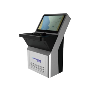
The XF-1069GF is a versatile marine navigation and fish-finding unit that combines GNSS positioning, chart plotting, depth sounding and fish detection in a single integrated display. Its 10.4-inch color TFT LCD (800×600 px) delivers clear, wide-angle views of charts, sonar echoes, and navigation data.
XF-1069GF fish finder integrates GNSS, chart and fish finder. It supports two transmission frequencies of 50KHz and 200KHz, the transmission power is 600W. In addition, it is built in intelligent operation modes, such as auto bottom tracking, auto range, auto shift adjustment, auto gain, etc. Whether you are fishing on the coast or offshore, it can help you accurately locate the fish.
◆ Equip with high-quality transducer, transmitting power is 600W.
◆ Support two transmitting frequencies of 50KHz and 200KHz.
◆ With self-developed interference removal algorithm to suppress co-frequency interference effectively.
◆ Built in intelligent operation modes, such as auto bottom tracking, auto range, auto shift adjustment, auto gain, etc.
◆ Connect mobile network to support update software online.
Technical Specifications
| Display Unit | XF-1069GF | |
| Display Type | Color TFT LCD | |
| Size | 10.4 inch | |
| Resolution | 800*600 | |
| Brightness | 300cd/㎡ | |
| Interface | 2 Ports NMEA0183 Output, 2 Ports NMEA0183 Input | |
| Chart | Internal Chart & C-MAP(MAX) | |
| Power Supply | DC12V~36V | |
| WIFI | 802.11 b/g/n | |
| Power Consumption | 14W or less (24 VDC) | |
| GNSS | ||
| GNSS Receiver | 72 channels | |
| Receive Frequency | GPS L1: 1575.42MHz;BDS B1: 1561.098MHz | |
| Accuracy | GPS&BDS | 2.5m(CEP50% open sky) |
| GPS | 5m(CEP50% open sky) | |
| BDS | 5m(CEP50% open sky) | |
| Speed Accuracy | 0.1m/s(50%@10m/s) | |
| Time to First Fix | Cold Start <30s , Hot Start <1s | |
| Fish Finder | ||
| Transmit Frequency | 50/200KHz | |
| Transmit Power | 600W | |
| Depth Units | m/fm/ft | |
| Range Scope | The unit is m/fa: 2.5, 5.0, 10, 15, 20, 30, 40, 50, 80, 100, 150, 200, 300, 500
The unit is ft: 5, 10, 20, 30, 40, 60, 80, 100, 150, 200, 300, 500, 1000, 2000 |
|
| Display Modes | Single Frequency, Dual Frequency, Single Frequency/ Bottom Signal Frequency/Zoom in sea bed, Signal Frequency/B.D. | |
| A-Scope | User can switch on/off the A scope | |
| Gain Control | The adjustment range of each operating frequency is 31 levels | |
| STC Level | The adjustment range of each operating frequency is 10 levels | |
| Echo Color | Available in monochrome,8 colors,16 colors | |
| Echo Single Level | 1,2,3,4 | |
| Echo Background | Blue, Black, White | |
| Decolouration | Provide 4 weaker echo colors and can be closed | |
| Seabed Contour | Highlight the display of the bottom of the seabed | |
| Image Speed | 0 1 2 3 4 5 6 7 8 | |
| Noise Reduction | Low, medium and high | |
| Depth Alarm | Depth-water, Low-water | |
| Fish Alarm Color | 1L(Weak) 2L 3L 4L(Medium) 5L 6L 7L(Strong) | |
| Alarm Size of Fish | Small, Medium, Large | |
| Depth Reading | Depth line position adjustment is flexible, and can be read in real time | |
|
Water Depth Correction |
1500 m/s, Adjustable range,1400-1600m/s | |
| Waterline Correction | Adjustable 0.1 unit at a time, adjustable range, 0.0-19.9 | |
|
The Output Statement of Water Depth |
$XXDPT (NMEA-0183) | |
| Environmental | ||
| Working Temperature | -20℃~+60℃ | |
| Storage Temperature | -15℃~+55℃ | |
Reviews
There are no reviews yet.